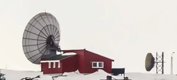
TELE Greenland maintains an emergency and safety watch on shipping in Greenland waters. TELE Greenland also attends to vessels’ requirement for commercial communication by radio (VHF, MF and HF).
The options for vessels to obtain information about the weather and ice conditions and any hazards to navigation in Greenland waters are discussed below:
Warnings of ice accretion
Warnings are issued by the Danish Meteorological Institute (DMI). Warnings of ice accretion will be broadcast by Aasiaat Radio on ships frequencies and channels. Kalaallit Nunaata Radioa (KNR) will broadcast on public FM transmitters in the cities and on medium wave at sea and in fiords.
For details on warning districts, guidelines for the preparation and distribution of ice accretion warnings, diagrams used to estimate the degree of ice accretion and masters’ duty to submit reports on ice accretion, see the annex to Notices to Mariners (EfS), EfS A, on the website of the Danish Maritime Authority.
Meteorological notices
Weather forecasts, marine forecasts and any gale and storm warnings and warnings of ice accretion are issued by Danish Meteorological Institute (DMI) and are broadcasted by Kalaallit Nunaata Radioa (KNR). Gale and storm warnings and warnings about ice accretion are transmitted by Aasiaat Radio on MF and VHF in English, Greenlandic and Danish. The warnings for storm, gale and icing transmitted via Aasiaat Radio will be sent at these fixed times: 0905, 1305, 1805 and 2305 utc during wintertime, and 0805, 1205, 1705 and 2205 utc during summertime.
The warnings will be announced only on MW 2182 kHz and the VHF channel 16 before sent on normal working frequencies. However, warnings received at other times will be announced via MW DSC 2187,5 kHz, MW 2182 kHz and the VHF channel 16 and transmitted as the radio regulations say.
If no new warnings are received to broadcast or a warning is still in force at the time for transmission the message: “No new warnings received” will be transmitted.
An overview of MF and VHF telephony, including locations and frequencies/channels that are used for the individual warning districts, can be found in the annex to Notices to Mariners (EfS), EfS A on the website of the Danish Maritime Authority and TELE Greenland www.coastalradio.gl.
The part of the Danish Meteorological Institute’s website that covers Greenland has an overview of the weather, current weather information (temperature, wind, air pressure, humidity, and precipitation), weather forecasts (coastal wind and wind), sea forecasts, ice charts, ice notices and tide tables.
The website of the Centre for Ocean and Ice (COI) at the Danish Meteorological Institute (DMI) has forecasts and observations of the Greenland waters. Waves (height and direction) and wind (force and direction) are among the parameters for which the website provides forecasts.
Ice service and ice charts
The Greenland Ice Service is part of the Danish Meteorological Institute (DMI) in Copenhagen.
DMI Ice Service
Lyngbyvej 100
2100 Copenhagen Ø, Denmark
Tel.: +45 3915 7315
Fax: +45 3915 7300
Email: iskort@dmi.dk
Information from the DMI Ice Service can be considered as indicative for the ships’ masters.
The DMI Ice Service is staffed with specially trained personnel for the analysis of satellite data for ice information.
The part of the Danish Meteorological Institute’s website covering Greenland has ice charts and inshore ice report in Danish and Greenlandic.
Transmission of Ice charts via e-mail
Ice charts are sent via e-mail as pdf files in black and white version in either low resolution (100 dpi, 20 - 30 kb) or in high resolution (300 dpi, 50 - 80 kb). Please write to the DMI Ice Service for receiving ice charts via email.
Transmission of Ice messages via Greenlandic Broadcasting Corporation (KNR)
DMI is compiling an inshore (indenskærs ismelding) ice message over South Greenland (3-5 times a week), this compiled ice message is broadcasted by KNR in a Greenlandic & Danish service broadcast. Please write to the DMI Ice Service for receiving the inshore (indenskærs ismelding) ice message over South Greenland (3-5 times a week) via email.
Reduced Ice Report from coastal radio stations.
For each Cape Farewell ice chart (DMI chart 1) a Reduced Ice Report is prepared. The Reduced Ice Report indicates the ice's outer limits. The information is transmitted via NAVTEX.
Maritime safety information
Joint Arctic Command (AKO) issues navigation information as required.
The navigation information broadcast over Kalaallit Nunaata Radioa (KNR) is read out in Danish and Greenlandic so that mariners can get updates on changes to buoyage or warnings about newly discovered dangers to navigation.
Maritime safety information is broadcast by Aasiaat Radio in Danish and English.
The Joint Arctic Command (AKO) collects and distributes information about the buoyage along the Greenland coast.
The maritime traffic is very dependent on the reports submitted by mariners regarding extinguished lights, damaged or missing beacons and sightings of unknown reefs in the surveyed waters. Such messages can be called in by telephone directly to AKO or through the police, municipal officers and Aasiaat Radio.
For further information on the issuing of maritime safety information, see the annex to Notices to Mariners (EfS), EfS A, on the website of the Danish Maritime Authority.
NAVTEX
Many areas of the world, including Greenland, use the international system, NAVTEX, for broadcasting important and vital information to the maritime traffic. The NAVTEX system is part of the Global Maritime Distress and Safety System, GMDSS, and must be available on all cargo ships in international trade, on all passenger ships and on the largest fishing vessels.
Greenland waters are covered by 2 transmitters located in Iceland at Grindavik and Saudarnes (East Greenland) and 3 transmitters located at Simiutaq, Nuuk, and Upernavik respectively (West Greenland).
The broadcasts are operated remotely from the Joint Arctic Command (AKO). It is therefore the Maritime Rescue Coordinator Centre Nuuk (MRCC Nuuk) that edits and transmits the safety messages via NAVTEX.
For details on the NAVTEX system’s categories of messages and broadcast hours and areas, see the annex to Notices to Mariners (EfS), EfS A, on the website of the Danish Maritime Authority.
Broadcast hours and areas are also listed in the radio handbooks, for example UKHO NP285, Admiralty List of Radio Signals, Volume 5 - Global Maritime Distress and Safety System (GMDSS).
Navigational warnings
Messages of importance to the safety at sea which cannot be published in Notices to Mariners (EfS) with sufficient notice, are broadcast by Aasiaat Radio as Navigational warnings. The coastal radio stations broadcast the notifications by radio telephony in both Danish and English. They are prepared by the Joint Arctic Command (AKO) in Nuuk.
For details about the structure of the messages, broadcasting stations, frequencies, broadcast hours and period of transmission, see the annex to Notices to Mariners (EfS), EfS A, on the website of the Danish Maritime Authority.