Mariners can obtain information for the safe navigation in charts and nautical publications. The Danish Geodata Agency publishes the official paper charts, electronic navigational charts (ENC) and nautical publications of the Greenland waters.
Mariners should be aware that the majority of the paper charts for Greenland were originally compiled in the 1960s. The source material on which these paper charts are based had limitations, especially with regard to their geometric accuracy.
The positioning of the information in these paper charts (i.e. topography, including the coastline, and hydrography) is therefore not accurate.
Since the positioning accuracy that can be achieved with satellite navigation systems (for instance GPS) is better than that of the paper charts, mariners are advised to use sources of positional information other than satellite navigation systems.
Read more about the precautions that mariners should take when planning navigation with Greenland charts.
Electronic Navigational Charts
The current ENC coverage of Greenland waters can be seen in the IHO World Catalogue.
ENC's with Limited Content - A Guide for Mariners
What are Limited Content ENCs?
In 2021 the Danish Geodata Agency (DGA) began an initiative to increase the speed of release of Electronic Navigational Charts (ENCs) covering southwest Grteenland. The goal is to release ENCs referred to internally as 'Limited Content ENCs'. The ENCs contain a newly georeferenced coastline and depth information derived only from modern multibeam survey information. Areas with depth information derived from multibeam surveysare hereafter referred to as "multibeam areas". Other information essential for safe navigation such as Aids to Navigation are also included.
However, other information outside the multibeam areas or not deemed essential is not captured. These ENCs are normal, standard ENCs and are distributed through the normal channels. Once released, these ENCs follow the same updating regime as existing ENCs.
Background:
DGA has a planned work program to replace the . This work has been underway for many years. The main benefit of these new charts is to publish products suitable for satellite navigation, with an accurate georeferenced coastline and depth information derived from modern multibeam surveys.
When the new paper charts and ENCs are produced they are often a mixture of new survey data and older bathymetric data from a range of sources such as single beam survey data, reported tracks of soundings, lead line measurements etc. It can take a long time to safely deconflict positional issues between modern surveys and older bathymetric information, which can slow the production process.
A decision was made to release depth information only derived from the modern multibeam data in an ENC format, where it is available, to provide safer navigation for the mariner. Often these modern surveys cover areas that have very limited published information. These ENCs are termed as ‘Limited content ENCs’. The older bathymetric information is not included at this stage but will be included when both the paper and ENC products are brought up to full content in the future.
Benefits:
The benefit to the mariner is that this releases modern, reliable depth information in areas that are often currently poorly covered, increasing safety to the mariner. These ENCs will also allow for satellite navigation to be used as they are positionally accurate.
Another benefit is that the modern data will be available for use by mariners, potentially years ahead of schedule.
What the mariner needs to be aware of:
Not all information is included in Limited Content ENCs, therefore it is important that the mariner is aware when they will need to refer to the existing paper chart and navigational publications for full information. It is important that mariners refer to existing paper charts if they navigate outside of the charted multibeam areas.
| Feature |
Limited Content ENC |
Older paper achart |
Full content ENC & modern paper chart |
| Depth information |
Modern multibeam only. Sea areas outside of multibeam are captured as Unsurveyed Areas (UNSARE) |
Existing published depth information from a variety of sources. May not include modern multibeam. |
Modern multibeam and older depth data |
| Coastline |
Modern georeferenced coastline |
Old coastline, potentially not positionally accurate |
Modern georeferenced coastline |
| Aids to Navigation |
Full cell content |
Full content |
Full cell content |
| Submarine and overhead cables |
Full cell content |
Full content |
Full cell content |
| Wrecks |
Within multibeam survey area only |
Full content |
Full cell content |
| Obstructions |
Within multibeam survey area only |
Full content |
Full cell content |
| Rocks (underwater & awash) |
Within multibeam survey area only |
Full content |
Full cell content |
| Topographical data (land elevations, land features) |
Not captured unless a landmark feature is part of an Aid to Navigation |
Full content |
Full cell content |
| Place names |
Not captured |
Full content |
Full cell content |
Table 1. Summary of feature content between Limited Content ENCs and older paper charts
The 1960s paper charts are not being updated for the modern surveys, as they will be replaced in the near future by a modern correctly georeferenced paper chart, which will include the modern surveys. This means there may be discrepancies between the ENCs and the 1960s paper charts. It is possible to identify a paper chart produced from older data as this is highlighted on the paper charts in the Notes section ‘Accuracy of the Chart’, under the chart title. The positional accuracy of depth information is reflected in the ENC in the Quality of Data (M_QUAL) meta feature and the Category Zone of Confidence (CATZOC) attribution. However, all modern surveys have been assessed against the existing published data, including the 1960s (and older) paper charts and if any safety critical information was found this has been released through the Notice to Mariners or Chart Corrections service.
It should also be noted there has been a shift in naming policy. Newly produced ENCs and paper charts use modern Greenlandic spelling and place names. Older products will still contain older Greenlandic spelling. These will be modernised as new products are produced.
When the Limited Content ENCs are brought up to full content and the new paper chart is released, there will no longer be significant discrepancies between the products.
How do I know which cell is Limited Content and which are Full content?
The difference between Limited Content ENCs and Full content ENCs is not immediately obvious.
DGA draws the mariner’s attention to the Limited content ENCs in two ways:
- There is a Nautical Publication Information (M_NPUB) feature captured over the whole area of the Limited Depiction ENC coverage area.
- There is a Caution Area (CTNARE) feature captured over the depth areas, from the coastline seaward. This CTNARE will trigger an alarm on the ECDIS to draw attention to the mariner.
LIMITED ENC DEPICTION:
Features in this area are limited to include only multibeam surveys, coastline derived from modern imagery and aids to navigation. Most other features, including bathymetry from older sources, are omitted in areas outside of multibeam surveys. Electronic Navigational Charts (ENCs) with areas of limited ENC depiction provide ENC users with multibeam bathymetry at a best scale where previously there was only smaller scale or no ENC coverage. Mariners are advised to refer to published Standard Nautical Charts for additional content outside multibeam areas.
Where can I get Limited Content ENCs from?
Limited Content ENCs are distributed and updated in the same manner as existing ENCs. Ships with their own IMO number can buy ENCs via a Value Added Reseller (and their distributor network) under IC-ENCs distribution network as they are released.
Further information can be found via this link about access to Limited Content ENCs (in Danish).
Progress to date and expected deadline
So far 37 Limited Content ENCs have been released in SW Greenland, with a goal for the final Limited Content ENCs to be published by the end of 2023. The process will then continue by bringing the ENCs up to full capture
Summary
In summary, DGA has been distributing Limited Content ENCs since 2021. They provide a method to speed up the delivery of modern multibeam depth information which can be used for satellite navigation, to the mariner. However, not all features are captured on these ENCs and the mariner must use other existing paper charts to supplement these ENCs. Guidance is given in this document on what the difference in content is and how to identify Limited content ENCs.
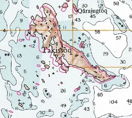
Index map of Greenland charts
An overview of the paper charts covering the Greenland waters can be found on the Danish Geodata Agency’s website.
Chart Corrections
When procuring paper charts and printed publications, subsequent corrections that are published in Chart Corrections must be entered in charts and publications by the mariner.
Chart Corrections is published every Friday and describes the corrections necessary to maintain the Danish Geodata Agency’s charts and nautical publications covering the waters surrounding Denmark, the Faroe Islands and Greenland.
Information is also provided about new editions and updated reprints of the charts and about the continuous updates to the Danish Geodata Agency’s online publications.
The Danish Geodata Agency’s website contains the latest version of Danish Chart Corrections and an archive of previous editions.
There is also a list of corrections to current paper charts listed chart by chart.
Notices to Mariners
The Danish Maritime Authority publishes weekly Notices to Mariners (EfS). Notices to Mariners announce matters of importance for shipping in Danish and adjacent waters, as well as waters around the Faroe Islands and Greenland.
Nautical publications
Nautical publications are a necessary complement to the charts. In connection with navigational planning, nautical publications are indispensable because this is where the mariner can obtain information that is not available from the charts. Like charts, it is mandatory to have nautical publications on board for a ship to be declared seaworthy.
The Danish Geodata Agency publishes a number of nautical publications, which can be purchased in print or downloaded from the internet. The nautical publications covering Greenland waters and harbours are primarily only available as online publications from the Danish Geodata Agency website.
Purchase of charts of Greenland waters
Rosendahls distributes all the paper charts and a range of nautical publications for the Danish Geodata Agency, covering Denmark, the Faroe Islands and Greenland. Paper charts and nautical publications can be purchased from the distributor website or at the distributor’s dealers.
Pilot
There is pilot services available that meets the requirements of the Danish Maritime Authority's "Order No 1698 of 11 December 2015 for Greenland on pilotage, etc. around Greenland" and the Danish Maritime Authority's “Order No. 1699 of 11 December 2015 on the activities of pilotage service providers and the obligations of pilots in Greenland”.
The boarding of pilots is normally the last port before calling Greenlandic waters, and disembarkation is the next port of call after leaving Greenlandic waters.
Many ships use the services of a local agent to order a Pilot, but it is also possible to order a pilot directly via:
DanPilot Greenland
E-post: greenland@danpilot.dk
Hjemmeside: www.danpilot.dk
Imaq Pilot ApS
E-post: mailto@imaq-pilot.com
Hjemmeside: www.imaq-pilot.com